
 bear number 1
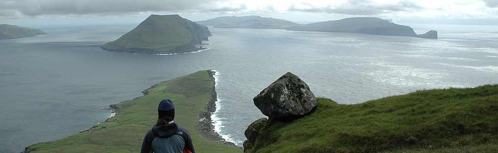
“Bear”, Larry pointed to the small low island just a few hundred meters away from where we had spent the past two nights. We had just got on the water to leave and I was looking ahead to the steep craggy mountains we’d soon be paddling past. I instantly turned my attention to Almaty Island, where I’d read that Nigel and Kristan Foster had camped when they paddled this route 20 years ago.
“Where?”, I said urgently. I didn’t see it and didn’t want to miss it.
“On the hill”, JF added. Finally when I lowered my gaze from the summit, I saw movement, the lumbering long white limbs of a specialized predator moving powerfully right to left along the slope. I was struck with how majestic and big he looked. Frank was boldly paddling in his direction, keen to get a closer look. I followed, a bit behind, not sure if that was a good idea but drawn to observe the bear in his element. The wind was blowing our scent away and the bear was striding purposefully over the rock, oblivious to us. What long fur he has on his legs, I thought, like hairy flares. About 100 metres away we stopped paddling. Finally the bear saw us and walked a few steps towards us, his nose held high and his tongue out to try to taste us on the air. He was so big! I was glad we were on the sea in our kayaks and he was on land. We watched each other for a few seconds and I hoped he would not come closer to investigate. He looked like he was deciding what to do before lumbering away over the low hill.
Wow, we all said. What a magnificent creature.
“It’s a male, probably four or five years old”, Frank shared. He got his phone out and entered the details on a bear tracking app that he’s contributing to.
The rest of us were feeling the chill from the SW wind that was ruffling the sea into small choppy waves. We paddled a few strokes away to warm up before waiting for Frank.
“Walrus”, JF pointed dead ahead about 60 meters away. A low grey back was just visible on the surface, like a tiny submarine, and as I watched two nostrils and a glimpse of two white tusks emerged in front of it. I’d read that walruses travel as far south as the northern tip of Labrador so we were lucky to see one at the edge of their range. The male came up to breathe again, and again, barely lifting his head, before disappearing from view.
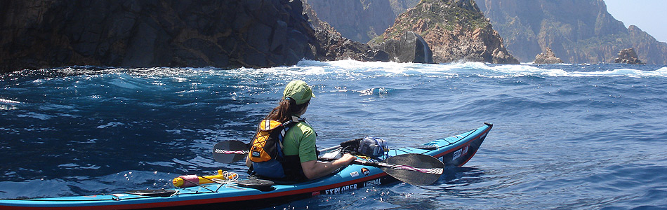
The four of us started paddling south past black domes of ancient rock. The horizon was hazy, perhaps from smoke from distant fires but the closer peaks were striking, rising precipitously from the ocean. I craned my neck up at near vertical gullies, with fans of sharp boulders extending down to the sea. Some debris channels had become gently sloped enough to support plant communities, others had been stable long enough to be black with lichen. More recent landslides were marked with lighter colored rock.
The breeze blew consistently and as we came to a headland we bounced through steeper waves, enough that our bows crashed down into them and slowed our progress. The extra roughness showed we were in a favorable current that opposed the wind. We are learning the rules of a new coastline and noted that the falling tide seems to create a south going current. We aimed for a Long skinny island about 2km off shore, hoping to see some wildlife as we paddled by the green lower slopes.
“Caribou”, JF called out excitedly. I followed his paddle signal and saw two gigantic curved sets of antlers trotting away over a hill. What a day for wildlife!
The antlers reappeared several times as we paddled south, sometimes with a third smaller caribou, and always in the distance. At the southern tip they were closer, ambling over a grassy area with their noses down, occasionally stopping to take a mouthful. We watched silently as one by one they strode deftly over the rocks towards the sea. Their fur was white and brown and their antlers almost black and velvety. The leader had four large dark lobes at the front. After a few minutes he walked down to the sea and walked straight into the water 60 meters away. The other two followed right behind and the tight knit group started swimming, noses, backs and racks above the water. We stayed still, excited and confused, not sure what to do. After a few strokes in our direction, the leader made a quick u-turn and headed back for shore. The others followed and they lumbered out of the water. A big shake sent water droplets flying.
What a day for wildlife! We also saw a ringed seal hurled out on a rock, heard the melodic call of the loon and saw our first groups of pretty harlequin ducks. The winds eased and we slid under the imposing cliffs of our first big cape, close enough to touch the few boulder beaches. We’re camped at a wide open valley on a flat patch of grass above a gravel and stone beach. Life is pretty damn good!
Larry is tracking our route on his Inreach every 10 minutes for anyone wanting to follow our progress. See my last Facebook post for details
rest day
Day 9 is our first day off from paddling. After a late finish yesterday, we didn’t feel like getting up early and pushing on. We are ahead of where we need to be and we’re making the most of the last cabin for a while to rest, repair things, eat food that takes longer to prepare, sleep, read and take in the beauty around us. Our little red shed is on the tip of Cape Labrador. I even love the name Labrador. To me, it evokes images of stark raw beauty, miles from people, a vast untamed wilderness. The type of place that excites me to the core. And now I’m here in the middle of that landscape, putting real memories to my imaginings. I’m sat now on the small deck of the cabin, about the size of a single mattress. Franks solar panel hangs from a nail board that’s over one of the small windows. It’s basically a plywood sheet with a grid of rusty nails hammered through from behind and protruding three inches. It’s designed to deter a curious, or hungry, polar bear. The kayaks sit in a star pattern on a grassy patch in front of me, half a paddle sticking upwards from each stern, ready to have our bear fence attached around them when we go to bed. The invisible fishing line makes a piercing wailing sound if any of us walk through it carelessly. No one has done yet, largely because we’ve agreed that the culprit does the washing up. If a bear comes to investigate the kayaks the sudden loud noise may deter it, or it will at least wake us up so we can scare it away.
A few feet behind the kayaks is a low cliff and beyond that the gently ruffled ocean and the stark bold Torngats mountains. A giant lump of grey mountain dominates the horizon, rising steeply to an undulating ridge line, a few stubborn snow patches filling deep gullies. It size makes it look close but my map tells me it’s 4km away and 1600 metres high. Impressive as it is, it’s not named which suggests to me that other peaks, like those marked Cape Kakkiviak or Hutton peninsula are considered more spectacular. We will see tomorrow when we hope to paddle past them.
A loose procession of ice bergs has drifted into the bay in front of us, cut loose from the thick pack we can see a few kilometers offshore. It looks like tomorrows passage is largely free from ice.
It’s cold, bitterly so when the sun disappears behind clouds and the winds blows from the ice pack. I have three layers on plus a wily hat and neck warmer. The plus side is there are few bugs, not yet here to seek out every exposed millimètre of flesh.
The day has gone fast. It’s nearly bed time. This is a great adventure in a stark and beautiful land.
ice bashing
The radio towers and derelict buildings of the former village stood high on the hill in front of us. We’d weaved around football fields of jumbled pack ice for 6 hours and were only 1km away from Killiniq but now a low flat shelf of ice blocked our path. Aborted attempts to go around it brought us back to the same 30 metre wide slab of sea ice with blue sea twinkling tantalizingly beyond. While I was wondering if the thin ice pan could take our weight, Frank jumped out onto it so fast that I didn’t see how he did it. He later told us that 2 inch thick ice will hold a man’s weight and he reckoned the pan was at least 8 inches thick, even on the crumbling edges. The rest of us were less sure. JF went first and paddled at the floe as fast as he could, his bow rising over the ice to about front hatch Level before it started to slide back into the sea. Frank grabbed his kayak and pulled it onto the ice, followed by Larry’s and mine. On the seal launch off the other side, my bow got stuck on another pan and when I tried to reverse off it my rudder jammed into the berg I’d just left. I could feel how thick the ice was as I struggled to free myself.
The ice was moving all the time, blown by the fresh westerly wind, pushed by the currents and jostled by each other. A passage through one minute was gone the next. I was last in our group weaving through a narrow corridor and I watched as 2 ice floes slid together in slow motion and closed the door to clear water right in front of me. I tried to bully my way through but was no match for several tonnes of frozen water. I backed off fearing my kayak might get crushed. Frank lept out onto the ice again and pulled me through. He told us he had walked a lot on similar ice when he rowed the northwest passage.
Safely through, we made our way to the former Inuit community of port burwell on Killiniq island. We’d been told there was an older freezer building that we could camp in and we were delighted to find it close to the water. Claw marks and an almost bashed in door showed us we weren’t the first to try to gain entry and reinforced why we wanted to sleep in there. We pried open the door, swept the floor of broken glass and moved in with our 4 kayaks and 2 tents. Larry and JF fixed the door with some old nails and set up a locking system in case any bears come by.
jF and I went for a walk around the former village, peering into the old generator building with rusty equipment, a workshop containing a rusty bulldozer and lots of rotting houses. Over 100 empty barrels of fuel lie piled on top of each other near a tip of wood and metal A fairly new satellite dish and communication antenna day higher up on the hill. The view from the village is gorgeous, looking towards McLean strait where we hope to find a way through the ice tomorrow. Everyone in the village was relocated in the 1970s and I wonder about their lives. JF and I met someone who grew up here where we paddled from Kuujjuaq to Saluit in 2017. I wonder which crumbling house was his.
It’s a great trip. Full of adventure. The ice today wasn’t really scary, but exciting. No bears yet. Let’s see what tomorrow brings.
ice ice baby
Larrys alarm went off at 2.30am as he wanted extra time to get packed and enjoy his coffee. Frank got up too and I dozed on and off through the pzzzz of deflating mattresses, the crunch of dry bags being tightly packed and patter of feet on the floor. All too soon JFs watch buzzed loudly by my ear. Surely that wasn’t 30 minutes already? We leapt into action; Jf packing away the sleeping stuff, me priming the stove for breakfast. The four of us moved the almost empty kayaks 200 metres down a path of sharp rocks and packed them at the waters edge. Mine still seems full to the brim even after eating 5 days worth of food. 90 minutes later, we pushed off close to high water, relieved to see that the semicircle of rapids that guards the bay was almost covered by the sea. We each choose a channel through shallow boulders and practiced our river running skills for 50 metres. Frank got caught up briefly on a boulder but skillfully pushed himself off.
Once in the open bay, a brisk wind whipped up the sea into short choppy waves. My mapcase was flung up into the air. Cats paws raced across the surface in the strongest gusts. Happily it was blowing from behind us and pushed us enthusiastically along our way. We had a maze of hundreds of islands, rocks, reefs and icebergs to find our way through. Navigating was challenging as the maps and charts don’t show accurately how much land dries out at low tide so we don’t know which channels between islands will be dead ends. There are so many rocks that aren’t on the chart that it’s tricky to know where you are. Hundreds of Icebergs caught up on shallow ground blocked our vision and sometimes our path. They were all around us today, some flat low white tables, others sculpted into beautiful glistening blue ornaments. We stopped to take photos of ones that had melted to look like a whale tail or the loch ness monster.
We didnt want to go too far out and around everything but we’re afraid of getting stuck on the inside and having to back track against the wind and current. In the end we skirted most of the islands, spending all day miles from the mainland. We were on the look out for bears amongst the ice. We haven’t seen any yet but we are getting to the area where they like to hang out. I wouldn’t be surprised if we see our first one tomorrow when we hope to get to kiliniq near the northern tip of Labrador.
After 40km we came closer to shore and scanned the sharp rocky cliffs for a possible campsite. We thought we saw a beach but as we got closer, it was a sand colored ramp of rock on a reef. Poking our nose into a wide rocky bay, we spotted a beige curve at one end. I tried to stop the excitement building at the sight of a steep sand beach. What if it was just another illusion? JF was less restrained and started yelping with delight at finding an oasis amongst all the rock. “Wow look at that beach. It’s the shortest and easiest portage ever in Ungava bay”. Then the excitement went up a level, “A cabin ! Look! There’s a cabin”.
It was indeed a beach. We pulled the kayaks up and clambered up the sand and gravel and over a berm to a flat plateau behind. The news about the cabin was less favorable. It was once a large building with three separate rooms and two wood burners. Now, one wall is missing, all the windows are empty and the roof is sagging and spewing thick insulation. It would offer no protection from bears. We set up camp at the top of the beach, had a wander up a hill to look down on our red hilleberg tents, and the vast Arctic landscape. I’m about to finish the first night watch shift. It’s 10pm and the sky is alive with the most glorious reeds and blues from the setting Sun. Another good day.