
 Vidoy and the Northern Isles

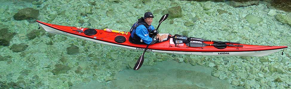
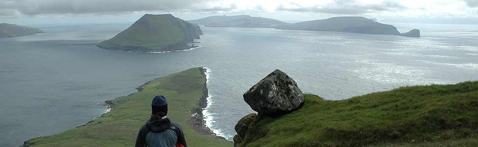
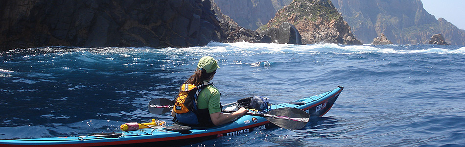
We are in striking fingers of the Northern Isles – long, thin, knobbly islands with impossible looking pointy moutains. Yesterday we kayaked on both sides of Kolsoy, which is 10miles long, less than 1 mile wide and over 500 metres high along most of its length. What an incredible ridge line! We were taking advantage of a beautiful sunny, calm and clear day, using the tides to go first down one fjord, and then after a stop for lunch in the working harbour( loud dredging machines clanking) at Leirvick, up the other side. After a brief view of the East side of Kolsoy, we actually paddled a short dog-leg, further east and north, around and up the Harraldsun fjord between Bordoy and Kunoy islands. We thought we would paddle under the bridge in Harraldsun and get the benefit of the ebb tide shooting up the fjord which is less than a mile wide. Unfortunately, we didn’t account for the fact that the ‘bridge’ isn’t a bridge yet! It’s a ‘temporary’ causeway, which seems to have been created from a quarry 20 metres away – dug specially for that purpose!? we kayaked closer and closer to the barrier, hoping we would spot the ellusive ‘way through’ as we got near to it, but soon we had to admit that we’d have a very long paddle back around the island, or we’d have a shorter, but more painful, portage, up a 45 degree slope of jagged broken rock, over a road, and down another 45 degree slope.
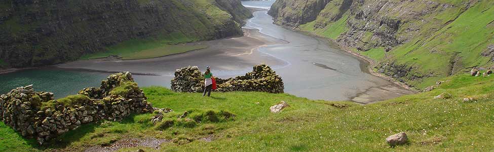
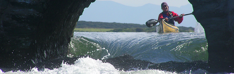
THE ‘BRIDGE’ IN HARRALDSUND We took the quicker option, and used some discarded planks of wood to slide the kayaks up and down which made it so much easier. It still took 45mins and felt painful! After that, we kayaked for another 2 hours, up and around the top of Bordoy, and 1mile across to Vidoy. As we approached the northernmost town on Vidoy at 10 o’clock at night, after over 25 nautical miles of paddling, our hearts sank again – although our map shows no contour lines here, and shows houses within 50 metres of the shore, it appeared to be only a grey wall of rock that greated us. Where would we land? We could have decided to paddle around the north end of Vidoy and land at the same village from the East side ( where we knew we could land) but it was late and we were tired. We are getting used to landing on fairly steep rocky places on this trip, and the sea was calm.
As we got closer, we saw people. “Great,they might help us land” I thought. But they stood there at the top of the cliff and took photographs as we managed to land alongside some low rocks, with just a little bit of swell making it interesting. The cliffs weren’t that steep, and we could see rotten wooden planks bolted to the rock where people used to launch their fishing boats. I guess no-one uses them anymore as most were gone completely, but it showed it was possible! So now we are camped in a stunning spot above the northernmost town in Vidoy island. It’s raining today, with low visibility and we have hitched 10 miles to Klaksvik – the biggest town in the ‘northern isles’, connected to Vidoy by another causeway. Tomorrow we hope to kayak to the easternmost island of Fugloy. This isn’t connected to any other islands by bridge, causeway or tunnel, so I’m looking forward to getting to the Eastern fringe!
I forgot to mention that we left Saxun after 3 days off and had an evening paddle of 10 miles to Eday. In the morning, we had decided not to paddle beacuse it was still windy, but as we were halfway through a walk over the mountains to Tgnavik (sorry for very bad spelling, I dont have a map here), the wind dropped and it became a beautiful day. so we finished our walk at about 6pm, hitched back to Saxun by about 8pm, and were on the water before 9.30pm to take advantage of the good weather window. We had a great evening paddle and made good progres with tide behind us. Going around the headland north of Saxun we could feel the sea restless beneath us ( Alun likens the tide races to sleeping monsters – even when it is calm, you can feel them beneath you stirring, throwing up a few waves, and you know that just a little bit of wind or swell will kick them up into big scary water. We don’t tend to hang about for long on these headlands. As the sun went down, making the sky pink and grey, the wind just started to pick up and we turned in land to Eday, where we enjoyed another portage up steep boulders to a nice campsite.
I just returned from a little paddling/vintage British car trip to Prince Edward Island and have been catching up on your ongoing trip. What a wonderful time you’re having! Are you taking some video footage we can expect to see at some point? I hope so.
Cheers to you both and safe paddling.
hi Michael,
Yes, I’ve been filming the whole trip and hopefully have some good stuff. I’ll be editing it all for a third video over the next few months. I might get it finished by Christmas, but I think it’s more likely that it will be in the first half of next year…